OUTLANDED


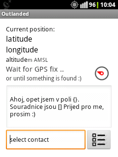
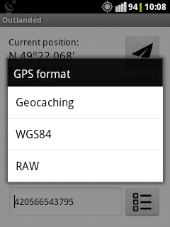
Although the navigation is pretty straightforward, the application's main screen contains several navigation items that might not be obvious at the first glance. Firstly, it is the GPS format dialog, which is accessible by clicking onto GPS coordinates on the top of the screen. The second is the Proximity item (the one with compass) that lets you choose which place in your neighbourhood you wish to send in the message.
Once having a valid GPS fix and chosen a valid contact, you can click on the send button, which gives you an option, how to send your message (either by SMS or any other available messaging application).

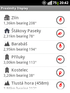
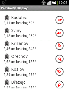
This screen shows places near to your position. I contains hamlets, villages, towns, cities and hills in your vicinity. By clicking on an item, this is chosen to be included in the message. Clicking on the back button, the nearest place is used.
The compass shows the actual direction to the particular place. When used in phones without magnetic compass the arrow displays bearing.
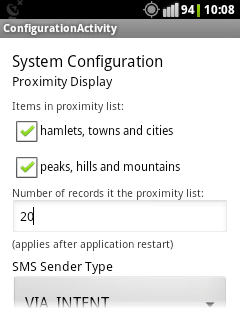
Type and number of items in the list can be specified in the app's configuration accessible from the main screen.
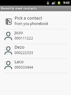
Initially, by going to contacts from the main screen your phone's phone book is open. Once a contact is selected, it is added to this recently used list. It is ordered with the most recent contacts on the top. This list can be cleant only by deleting the app's data.
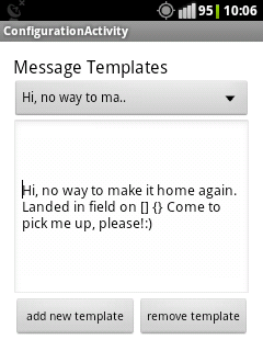
On this screen, message teplates can be added or removed. The currently selected teplate is then used by using the back button.

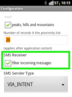
There is an option to capture incoming messages (SMS only) and consider those those with GPS coordinates in particular format (raw, geocaching or wgs-84) as oulanded emergency call. This feature can be turned on in the app's configuration menu (and is enabled by default).
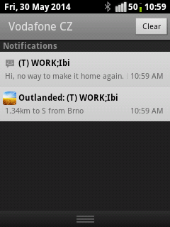
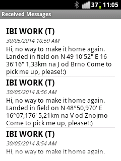
Information about a received message appears in the phone's notification area, bringing you directly to Outlanded's Message List. From here you can directly start an external map or navigation application to lead you directly to the received location.
This is the enclosing polygon for points shown on Proximity Display. (..and don't tell me anything about Uzhorod!;))